
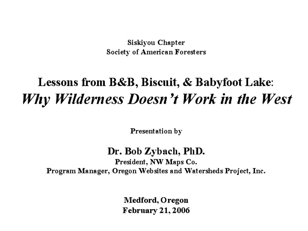
Siskiyou Chapter Oregon Society of American Foresters
Medford, Oregon February 21, 2006 Meeting Presentation
Lessons from
B&B, Biscuit, & Babyfoot
Lake:
Why Wilderness Doesn’t Work in the West
INTRODUCTION:
Picking Up from the Clinton Plan
The March-April 1994 issue of Evergreen Magazine featured a cover photograph and a comprehensive interview with Bob Zybach, both by Jim Peterson. The excerpted quote was in direct reference to snags remaining from the 1987 Silver Complex fires and to beetle-killed trees along the Santiam Pass. Although fire suppression has played a "partial" role in regional forest fuel build-ups, more important factors in recent fires have been 1) fire exclusion and 2) other reduced management actions, including logging, tilling, and firewood gathering (Montage: A. Gruen, ORWW).
Presentation by
["Introduction" video: 4:38 min., 38 mb. MPG]
President, NW Maps Co.
Program Manager, Oregon Websites and
Watersheds Project, Inc.
This presentation to the Siskiyou Chapter of the Society of American Foresters (SAF) was my first to this organization in 13 years; which had followed the local 1987 Silver Complex Fires and was given during the Clinton Plan for Northwest Forests discussion. At that time I expressed concern about the "Good Science" that was being used to shape the Clinton Plan, and demonstrated that the primary assumptions driving Good Science were not supported by the historical record and were, in fact, more mythical than factual in nature. I also confidently predicted a series of catastrophic forest fires instead of the forests of old-growth the Clinton scientists were projecting, if the plan were adopted. Jim Peterson saw a videotape of my presentation and decided to do an issue of Evergreen Magazine based on my research and conclusions; he did an excllent job and I continue to use his work as a reference to his Osborne centerfolds, and as the best representation of my own work at that time. The likelihood of the B&B Complex and Biscuit wildfires were clearly discussed and documented. Unlike Erlich's Population Bomb predictions, these turned out to be accurate; if anything, larger and sooner than expected.
Since that time I finished my graduate studies at Oregon State University, receiving my Masters in forest history and my PhD in Environmental Sciences. My doctoral research focused on the relationship between Indian burning patterns and subsequent catastrophic forest fire patterns in western Oregon. This talk is intended to pick up from where my last one left off.
The predictability of catastrophic-scale (100,000+ acres) forest wildfires is shown with a fire behavior triangle. When large quantities of highly flammable fuels -- such as dead, pitchy trees -- are ignited by people or lightning, they can burn so hot and rapidly as to create their own weather, including hurricane-force winds, tornadoes ("pyrocanes" and "pyronadoes"), lightning, and even rain. Fuel arrangements across the landscape, topography, and prevailing weather patterns are the principal constraints to these events; human firefighting actions are often dangerous, increasingly expensive, can cause unnecessary damage to soils and water, and are usually ineffectual until seasonal rains or lack of fuels put the fires out.
Several documented examples of the predictability of the B&B Complex and Biscuit forest fires in western Oregon are shown, including a recorded interview with a nationally prominent 90-year old forester, a newspaper article, reference to a forest scientist (Dr. Chad Oliver), and myself. The argument for logging recently killed trees for economic reasons has been made and is obvious. The argument has rarely been made -- in recent times, anyway -- that other values for logging dead trees also exist. Such values (and reasons) include human safety, wildfire management, cultural landscape restoration, visual aesthetics, wildlife habitat enhancement, species protection, vascular plant diversity, recreational access, and others. This presentation focuses on recreational, cultural, and ecological values that can be used to justify intensive logging on federal lands -- including Wilderness lands -- that have been subjected to catastrophic wildfire or other cause of widespread deforestation.
|
Program Slides |
Titles, Summaries, & Related Links |
Presentation Files |
 |
Lessons from the B&B, Biscuit, and BabyfootLake: Why Wilderness Doesn't Work in the West. Wilderness and LSR areas managed by the Forest Service in the western US have been bursting into unprecedented catastrophic-scale wildfires since 1987. These areas can all be charaterized as: 1)"passively managed" during the past several decades, and 2) fueled by widespread invasions and growth of native conifer trees. |
|
|
|
NW Maps Co. Co-sponsor: Albany, Oregon consulting business. Wildfire and prescribed fire planning, historical landscape research, tree farm and forest management planning, oral histories, forest and fire history research. |
|
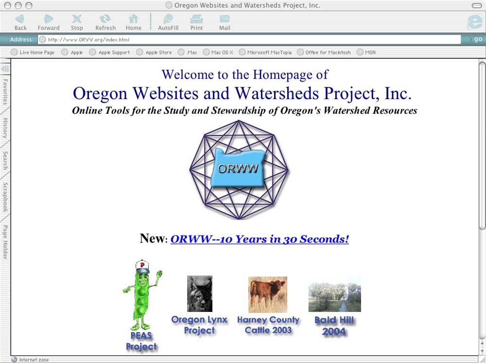 |
Oregon Websites and Watersheds Project, Inc. Co-sponsor: 10-year old, Philomath, Oregon 501 c(3) nonprofit, with a focus on science education, Internet communications, public peer review, and modern technology for scientific management of Oregon's natural and cultural resources. |
|
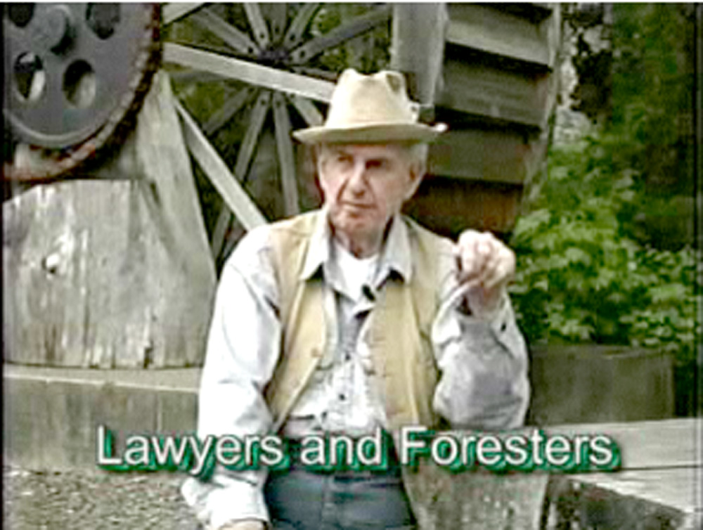 |
Bill Hagenstein: Lawyers & Foresters. Bill is introduced as my "co-presenter" for the evening, courtesy of a year-old ORWW website that features him; and of two computers, a projector, two speakers, an extension cord, a screen, and Josh. Bills gets to tell the obligatory humorous story to start things up, and he makes an important point (10 mb., 1:27 min.). | |
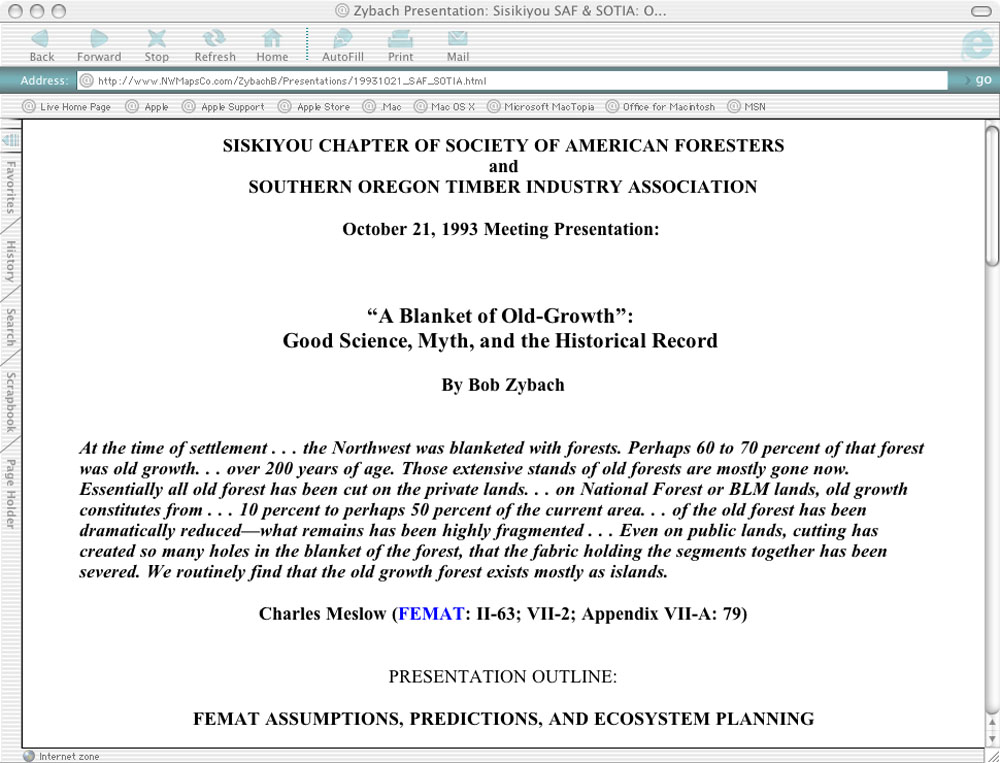 |
1993 Siskiyou SAF-SOTIA Presentation. This slide shows the heading of a two-page handout distributed during my last presentation to this group, 13 years ago. This was during the time of Clinton Plan (FEMAT) discussion, and Meslow's quote was the focus of my talk: an example of the "Good Science" based on debatable assumptions that was (and still is) driving federal forest policy. |
|
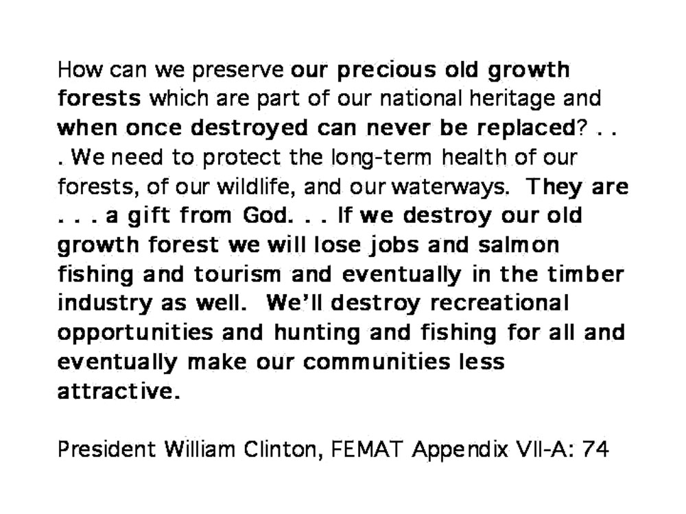 |
1993 Bill Clinton Quote. This quote was also included in the 1993 handout. It is included here as a bridge from that talk to this. The old-growth forests the President fears can be lost to logging, have been lost -- but to wildfire, instead. He thinks they are a "gift from God" and doesn't see the hands of thousands of families in the camas prairies, oak woodlands, berry patches, grain fields (and patches of old-growth) left by earlier people. | |
|
|
1994 Bob Zybach Quote. I concur with Chad Oliver and other forest scientists who understand how dead trees function during wildfire events, and why wildfire events will always occur, so long as grass, trees, and people coexist. This quote from me is in direct reference to the snags remaining from the Silver Complex (Biscuit), and the beetle-killed and stressed overstory trees of the Santiam Pass (B&B Complex), along Highway 20. | |
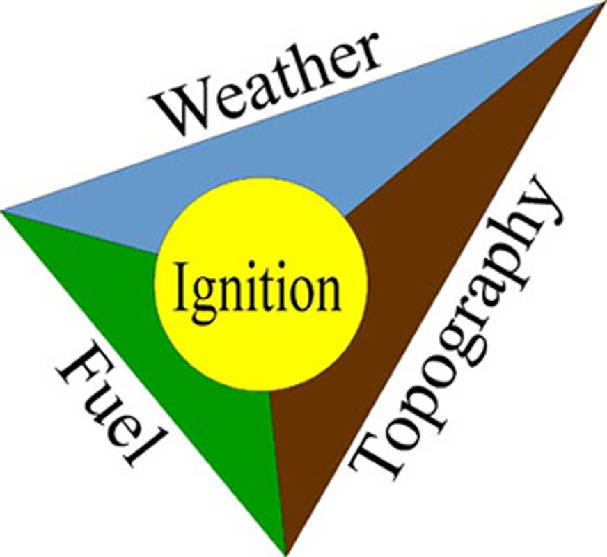 |
Fire Behavior Triangle: How to Predict a Catastrophic Wildfire. When the weather is dry, there is an east wind, and there are millions of tons of dry, pitchy firewood spread contiguously across tens of thousands of acres of land; a single lightning strike, careless smoker, or determined arson can start an uncontrollable fire that can reach catastrophic proportions in a few days or weeks time. It is that predictable. | |
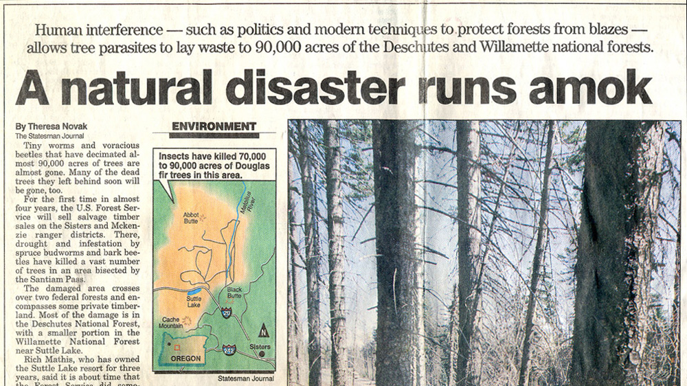 |
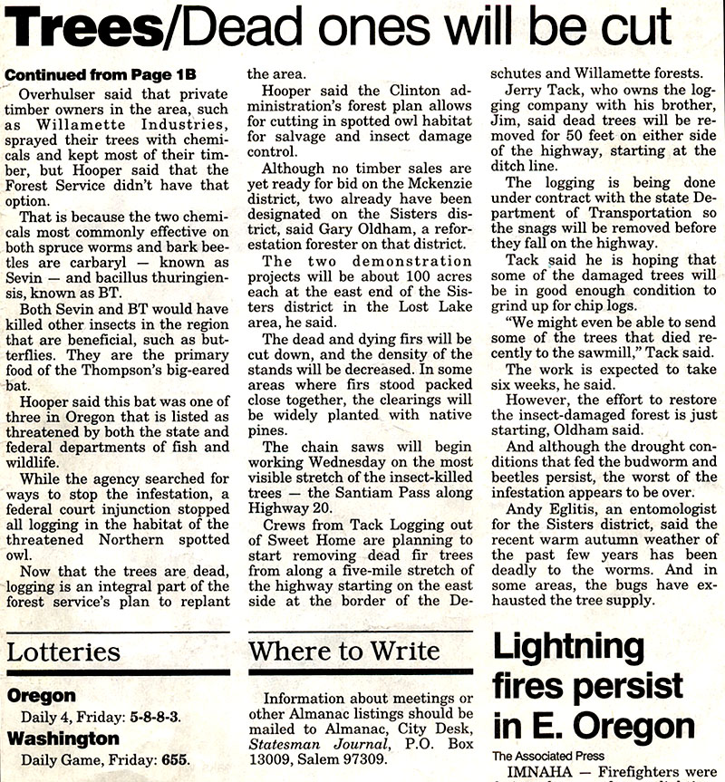
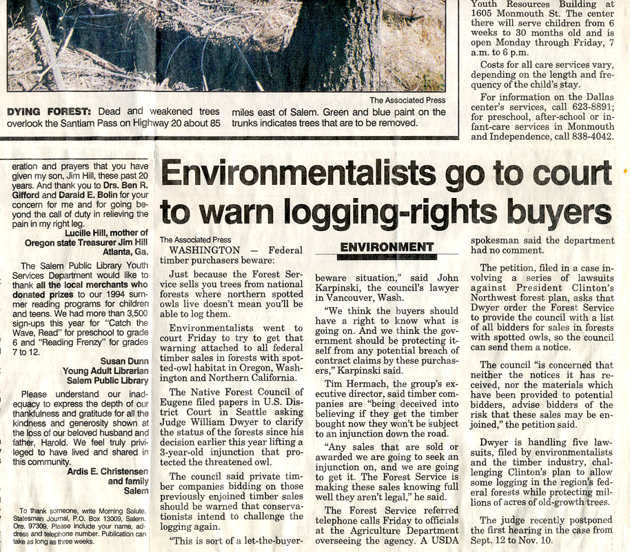
"A Natural Disaster Runs Amok."Sept. 3, 1994 Salem Satesman Journal article by Theresa Novak, focusing on fire danger posed by dead and dying trees on Santiam Pass. The USFS is quoted as saying the dead trees would be logged before they caught fire. A separate article about litigation by environmental activists said there would be no logging because the dead trees were within spotted owl habitat. | JPG |
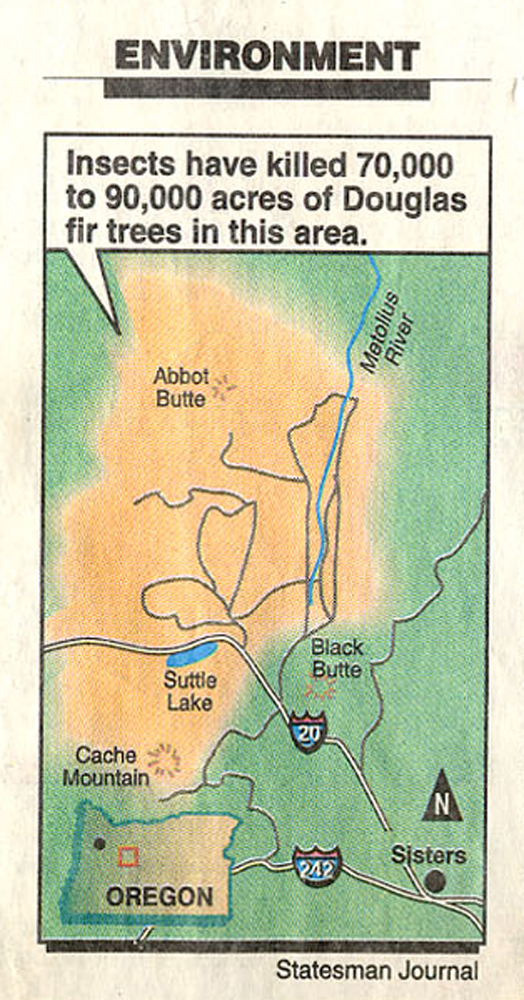 |
1994 Salem Newspaper Map of Santiam Pass Beetle-Killed Trees. This is a close-up of the map from the Novak article (above). NOTE: Abbot Butte, Cache Mountain, Black Butte, Metolius River, and Highway 20. |
|
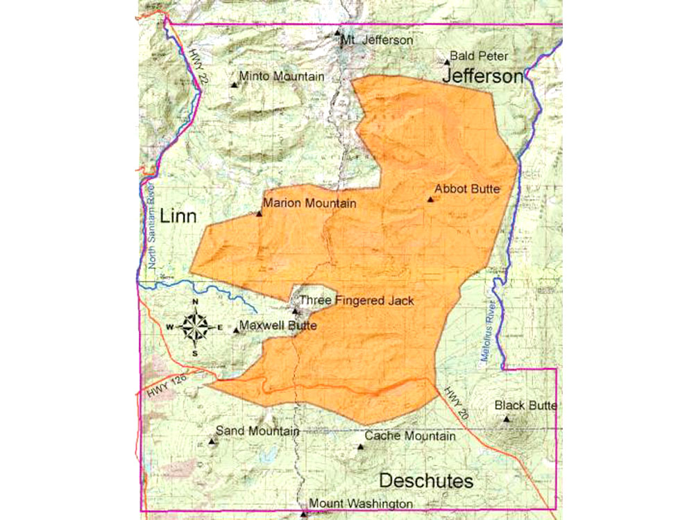 |
2004 ORWW GIS Map of 2003 B&B Complex Fire Boundary. This map was made and put online without knowledge or access to the 10-year old Novak map. It does not include the 2002 Cache Mt. Fires, which fit even closer. NOTE: the eerily similar colors chosen for beetle-killed and fire-killed trees; Abbot Butte, Cache Mountain, Black Butte, Metolius River, and Highway 20. | |
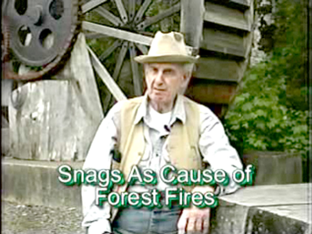 |
Bill Hagenstein: Wildfire & Snags. Bill predicts the 2003 B&B Complex Wildfires in a videotaped interview three months before they took place "on the road to Bend, Santiam Pass" (Highway 20). He has an MS in Forestry and nearly 75 years experience in industrial forestry, much of it on a national level. He has lived in the Pacific Northwest for more than 90 years (12 mb., 1:44 min.). |
|
|
|
B&B Complex Fires: Aesthetic & Recreational Values of Active Management | NEXT |
![]()
© 2006 NW Maps Co.