The Great Fires: Maps
![]()
Zybach, Bob 2018. The Great Fires: Indian Burning and Catastrophic Forest Fire Patterns of the Oregon Coast Range, 1491-1951 (2nd Edition). NW Maps Co., Cottage Grove, Oregon: 364 pp.
This is an index with links and and 2nd Edition page references to the 60 maps featured in The Great Fires. 47 of these maps are in color; 13 in black & white; 32 are free; and 28 maps are for sale for $3 or $5 each. All maps are sized slightly larger than the original print versions and can be printed on standard 8 1/2" x 11" copy paper. Free maps are in the form of 8" x 10" 200 d.p.i. (dots-per-inch) JPEGs and commercial maps are in the form of 300 d.p.i. PDF files that can also be printed on larger formats.
All uses of these maps are encouraged -- whether commericial, educational, or decorative -- with two requests: 1) please cite any use of these maps by author, title, publication year, and page number; and 2) the unrestricted uses of PDF map files are intended to be limited to purchasers and not be transferable to others: classmates, family members, business associates, employees, etc., are asked to purchase their own maps for personal, scholastic, or business uses.
| ICON | MAP | TITLE | PAGE | FORMAT |
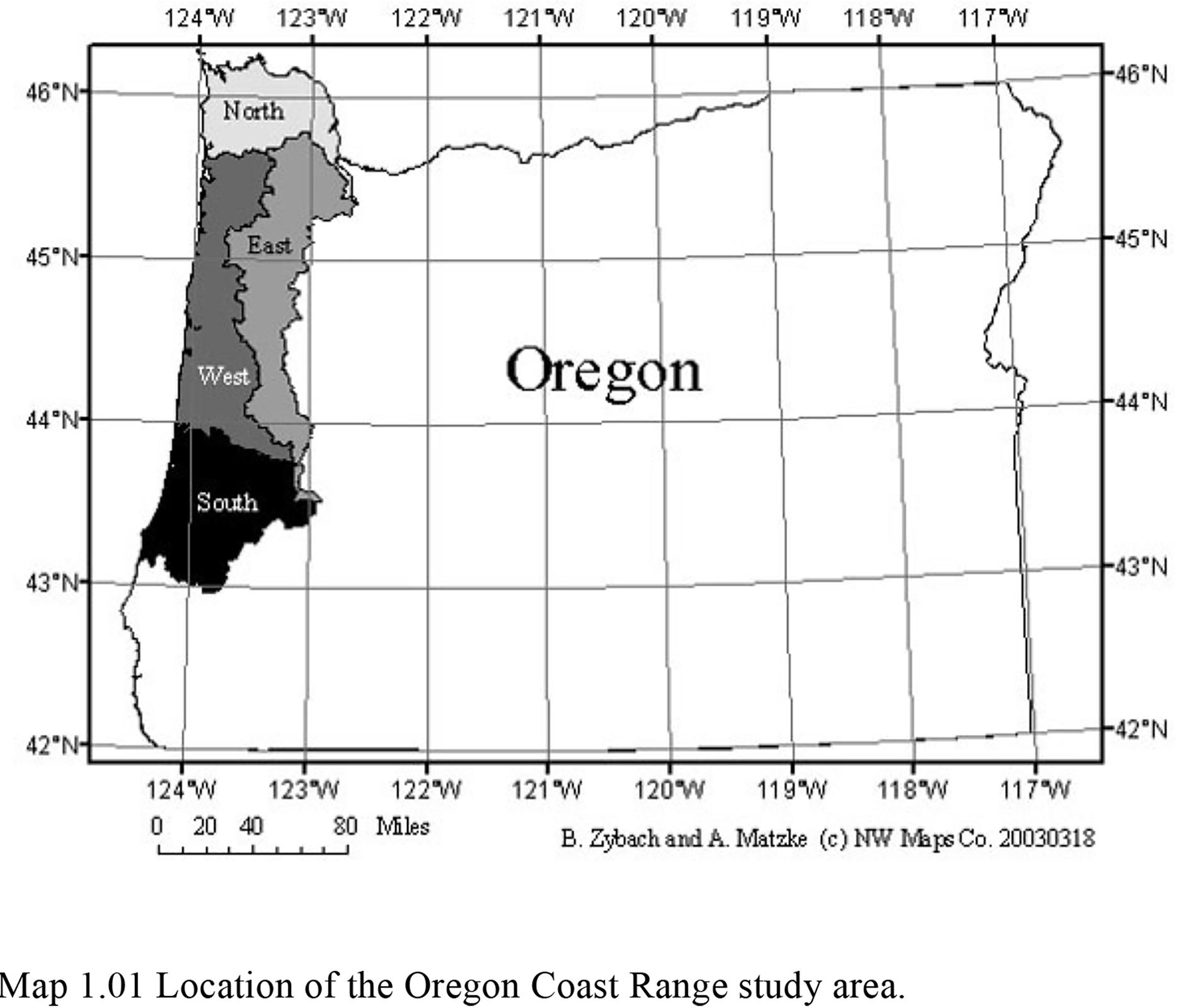
| 1.01 | Location of the Oregon Coast Range study area. | 3 | JPEG_FREE | |
| 1.02 | Topography of the Oregon Coast Range. | 11 | PDF_$3 | |
| 1.03 | Rivers and counties of the Oregon Coast Range. | 12 | PDF_$3 | |
| 1.04 | Precipitation of the Oregon Coast Range, 1961-1990. | 14 | PDF_$3 | |
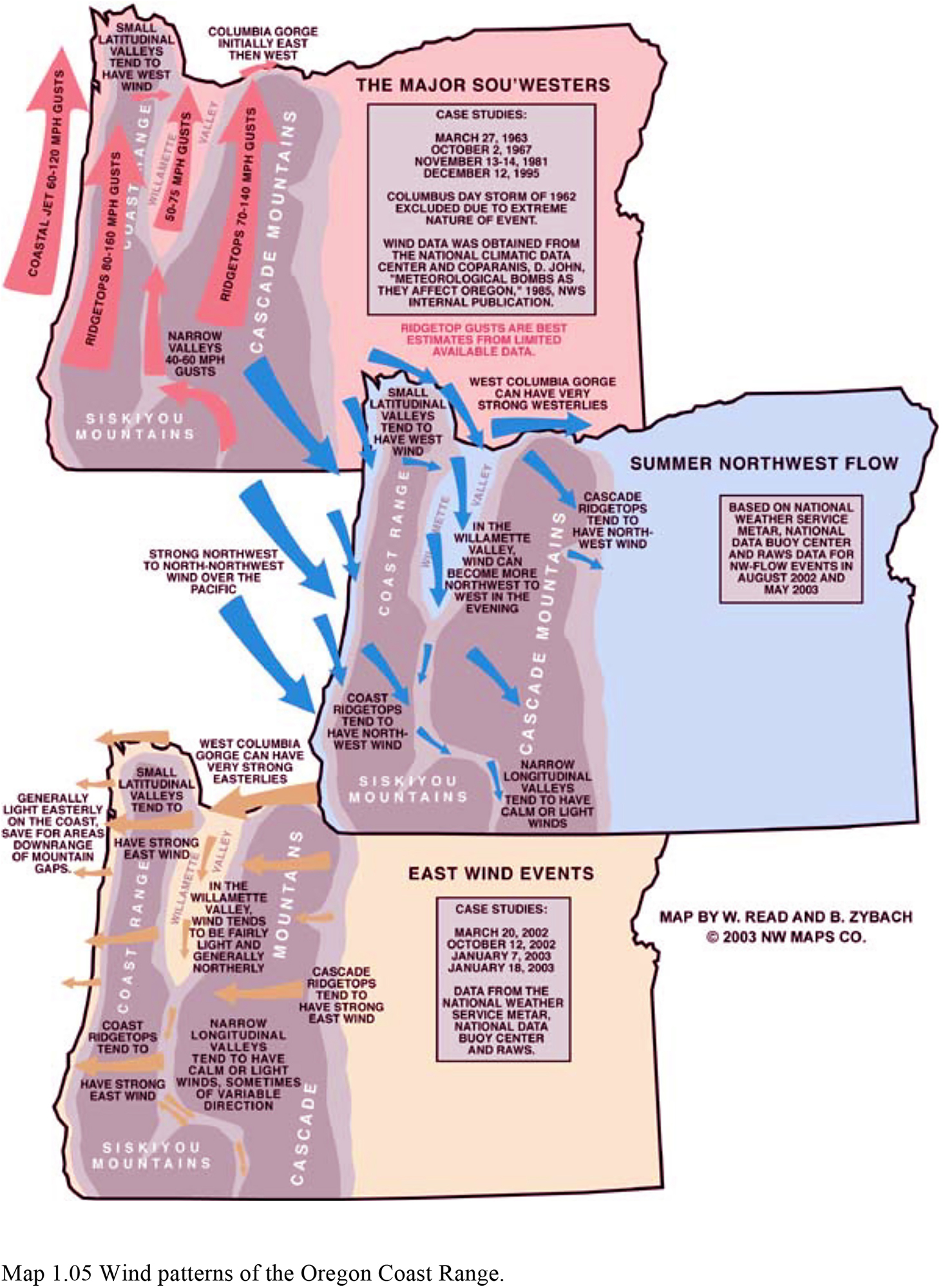
| 1.05 | Wind patterns of the Oregon Coast Range. | 19 | JPEG_FREE | |
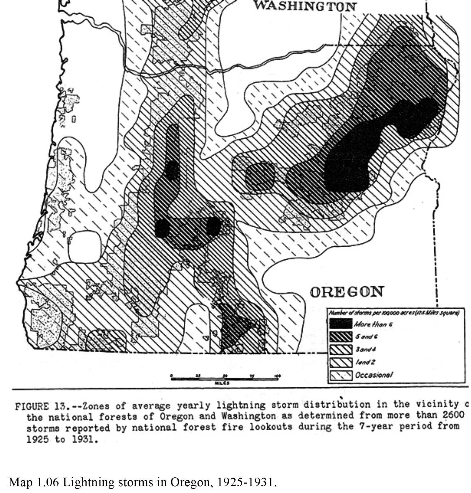
| 1.06 | Lightning storms in Oregon, 1925-1931. | 22 | JPEG_FREE | |
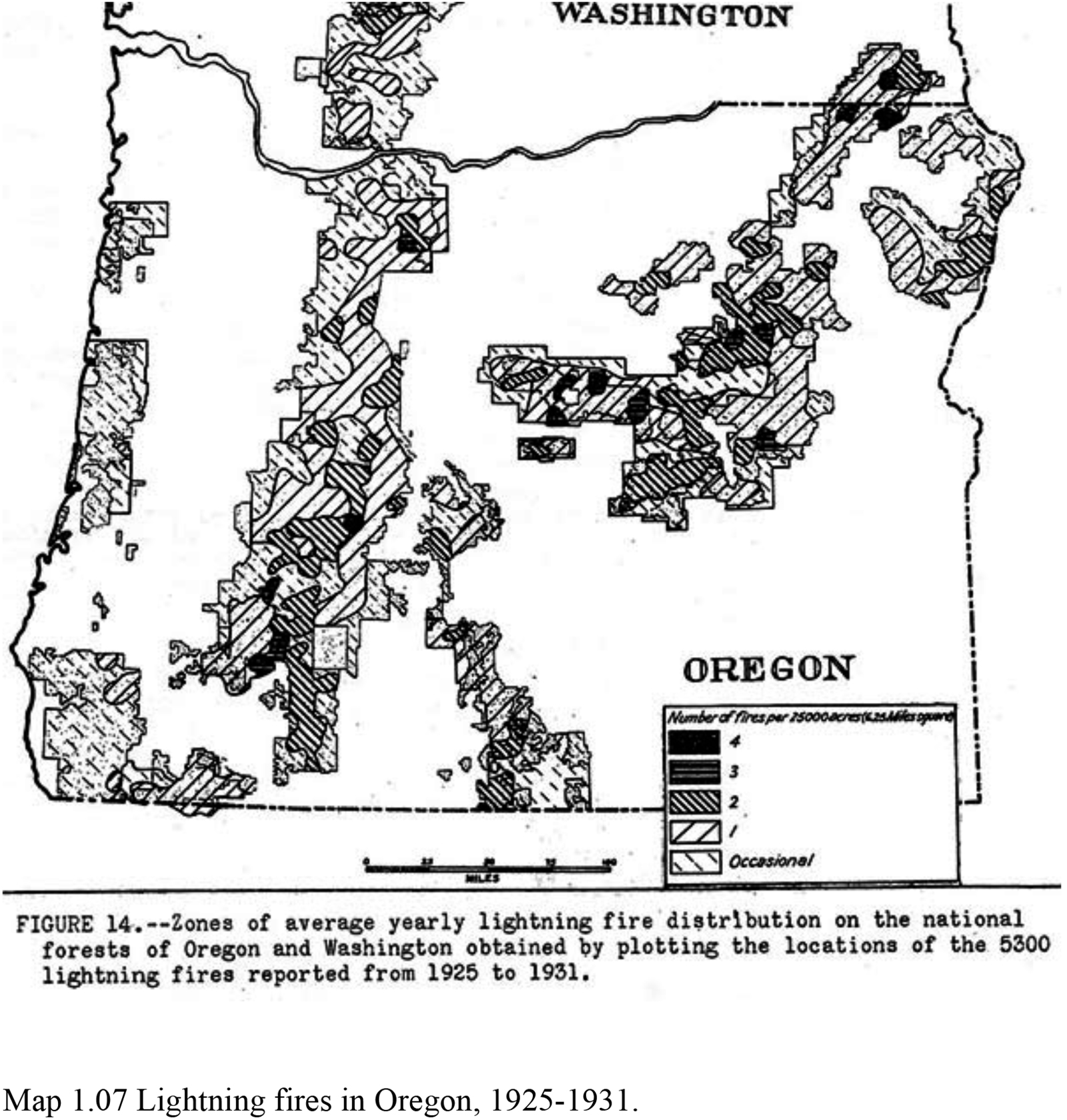
| 1.07 | Lightning fires in Oregon, 1925-1931. | 23 | JPEG_FREE | |
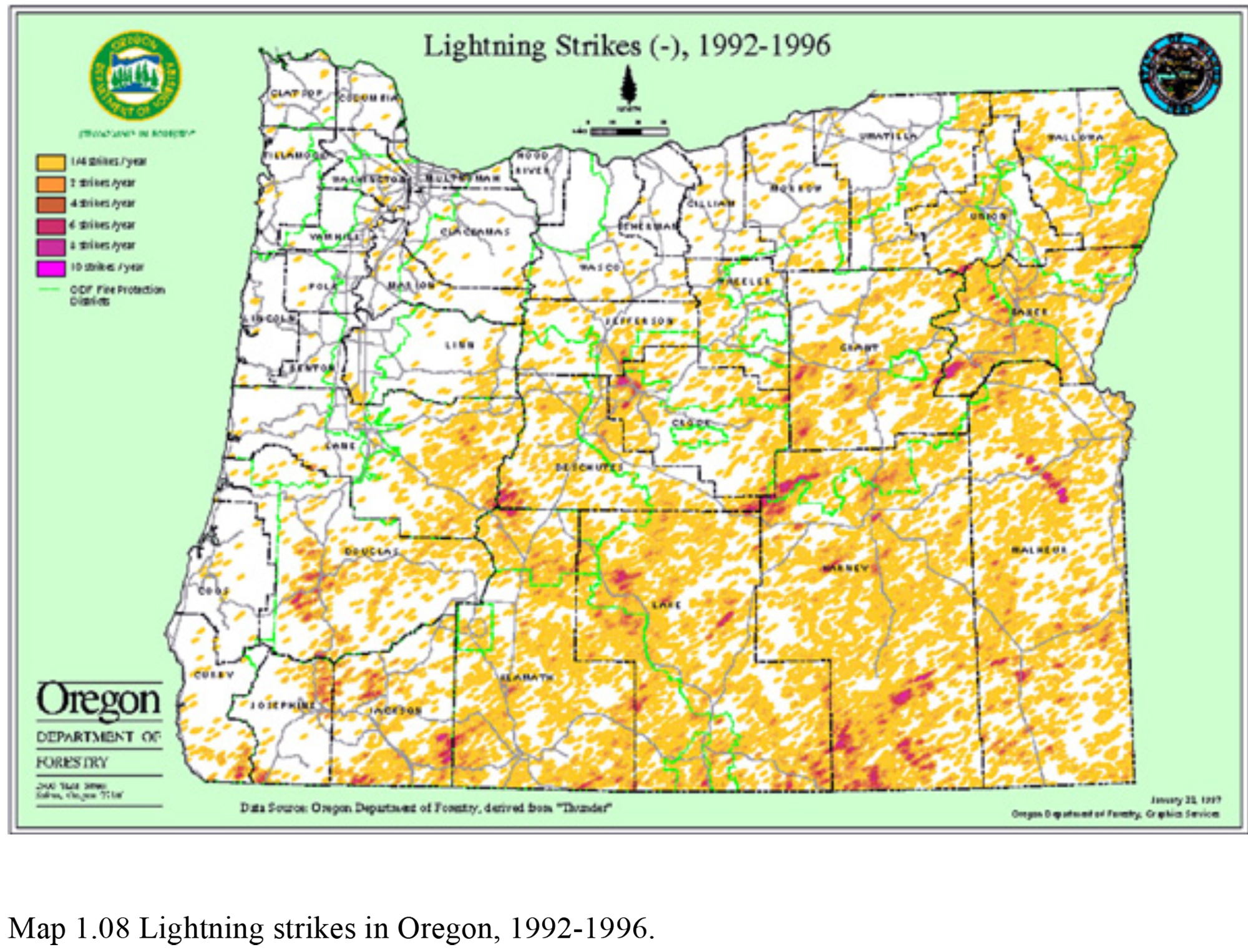
| 1.08 | Lightning strikes in Oregon, 1992-1996. | 24 | JPEG_FREE | |
| 1.09 | Current vegetation patterns of the Oregon Coast Range. | 28 | PDF_$3 | |
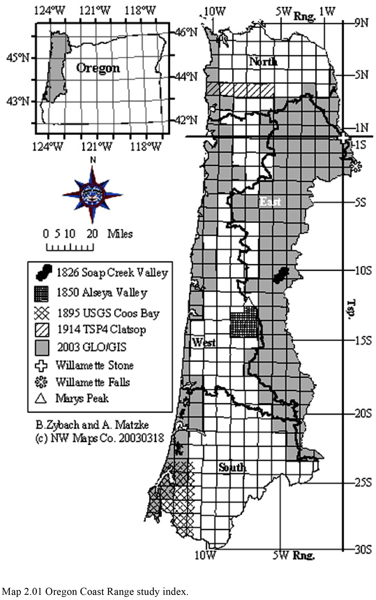
| 2.01 | Oregon Coast Range study index. | 42 | JPEG_FREE | |
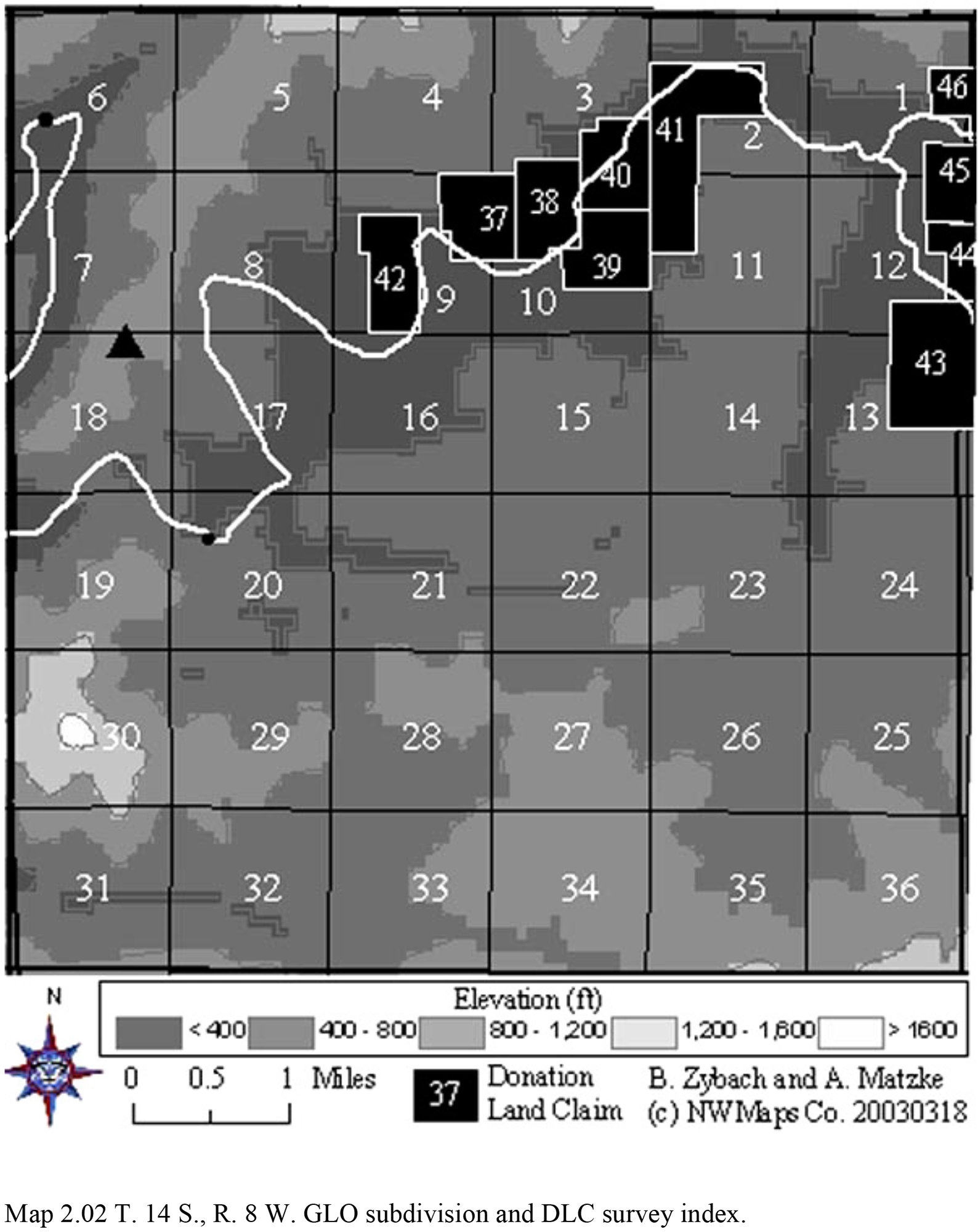
| 2.02 | T. 14 S., R. 8 W. GLO subdivision and DLC survey index. | 68 | JPEG_FREE | |
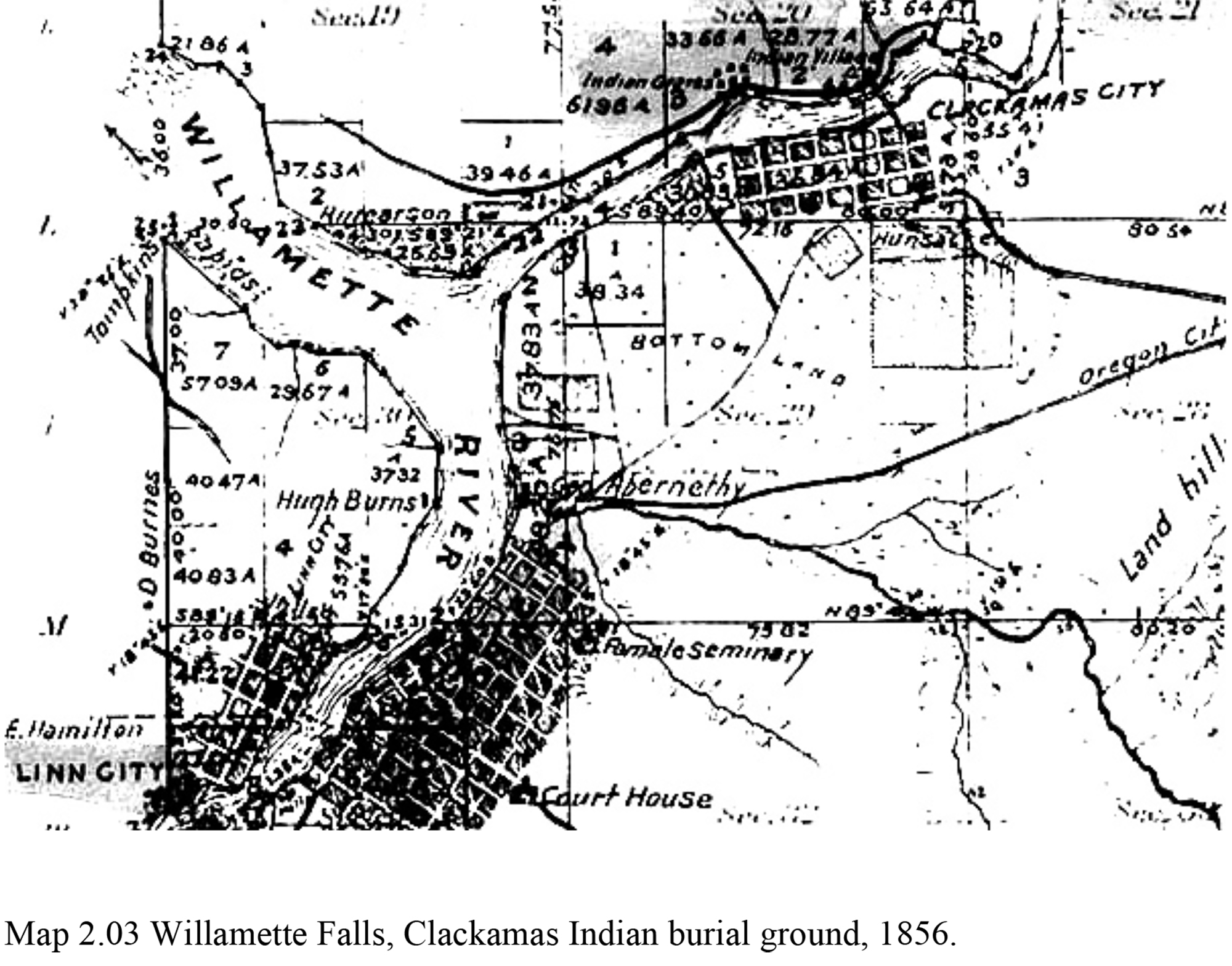
| 2.03 | Willamette Falls, Clackamas Indian burial ground, 1856. | 71 | JPEG_FREE | |
| 2.04 | T. 14 S., R. 8 W., Sec. 22 timber cruise, 1915. | 73 | PDF_$5 | |
| 2.05 | Oregon State Forester's Fire Map, 1914. | 74 | PDF_$5 | |
| 2.06 | USGS Coos Bay 30 min. quadrangle map, 1895-1896. | 76 | PDF_$3 | |
| 2.07 | 1895-1896 USGS Coos Bay Quad GIS map. | 77 | PDF_$3 | |
| 2.08 | 1900 USDI Forests of Oregon GIS map. | 81 | PDF_$3 | |
| 2.09 | 1914 ODF Forest Fire GIS map. | 82 | PDF_$3 | |
| 2.10 | 1936 PNW Forest Type GIS map. | 83 | PDF_$3 | |
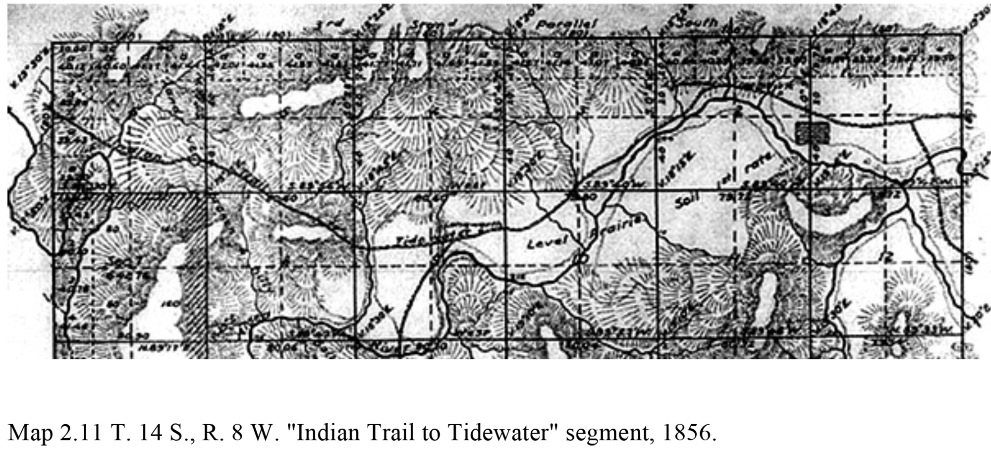
| 2.11 | T. 14 S., R. 8 W. "Indian Trail to Tidewater" segment, 1856. | 85 | JPEG_FREE | |
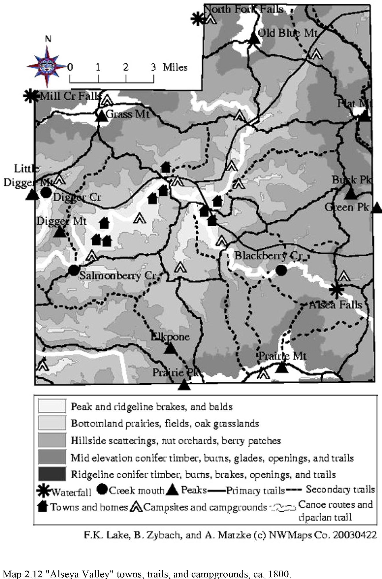
| 2.12 | "Alseya Valley" towns, trails, and campgrounds, ca. 1800. | 86 | JPEG_FREE | |
| 2.13 | "Alseya Valley" land use patterns ca. 1850 GIS map. | 89 | PDF_$3 | |
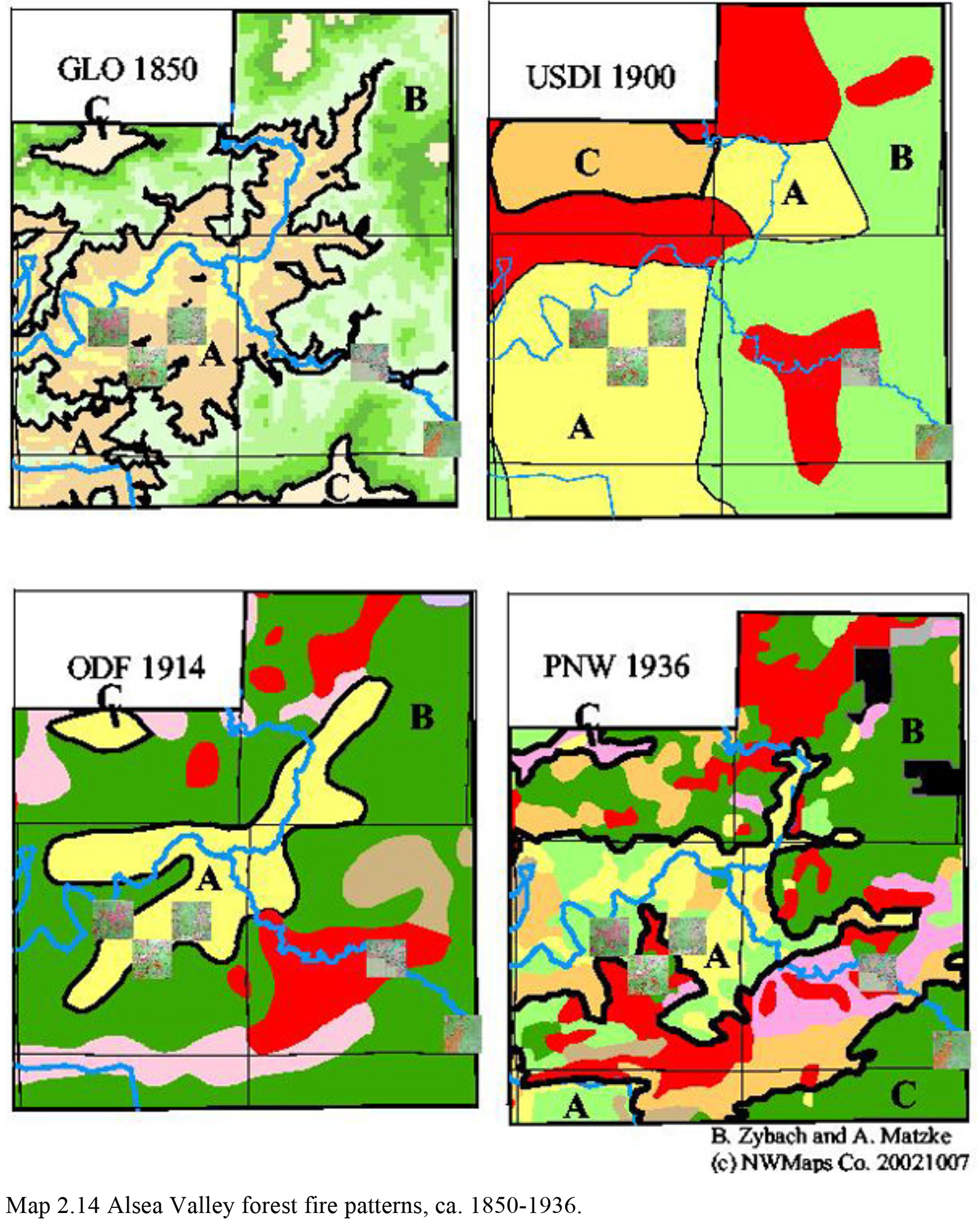
| 2.14 | Alsea Valley forest fire patterns, ca. 1850-1936. | 92 | JPEG_FREE | |
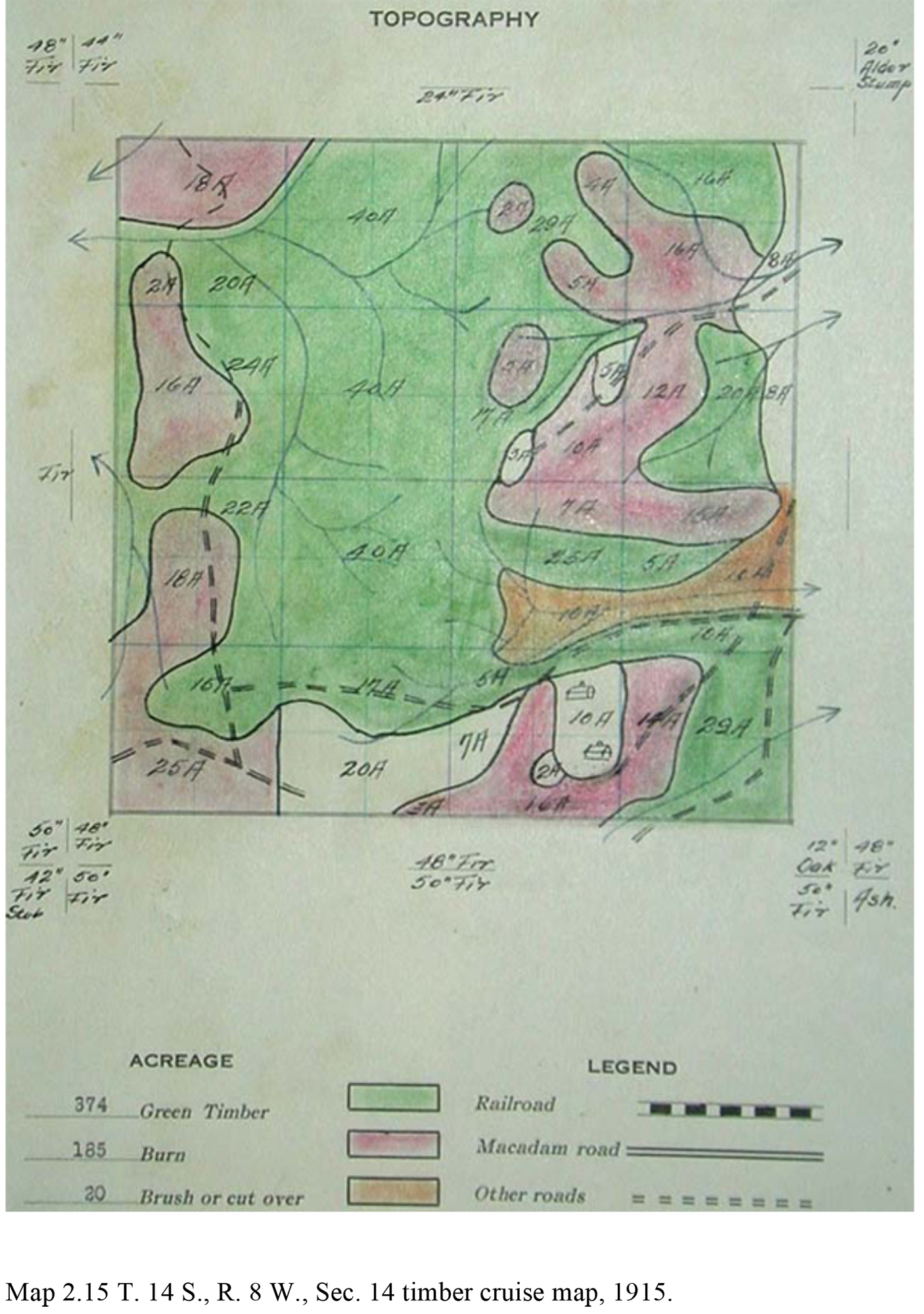
| 2.15 | T. 14 S., R. 8 W., Sec. 14 timber cruise map, 1915. | 94 | JPEG_FREE | |
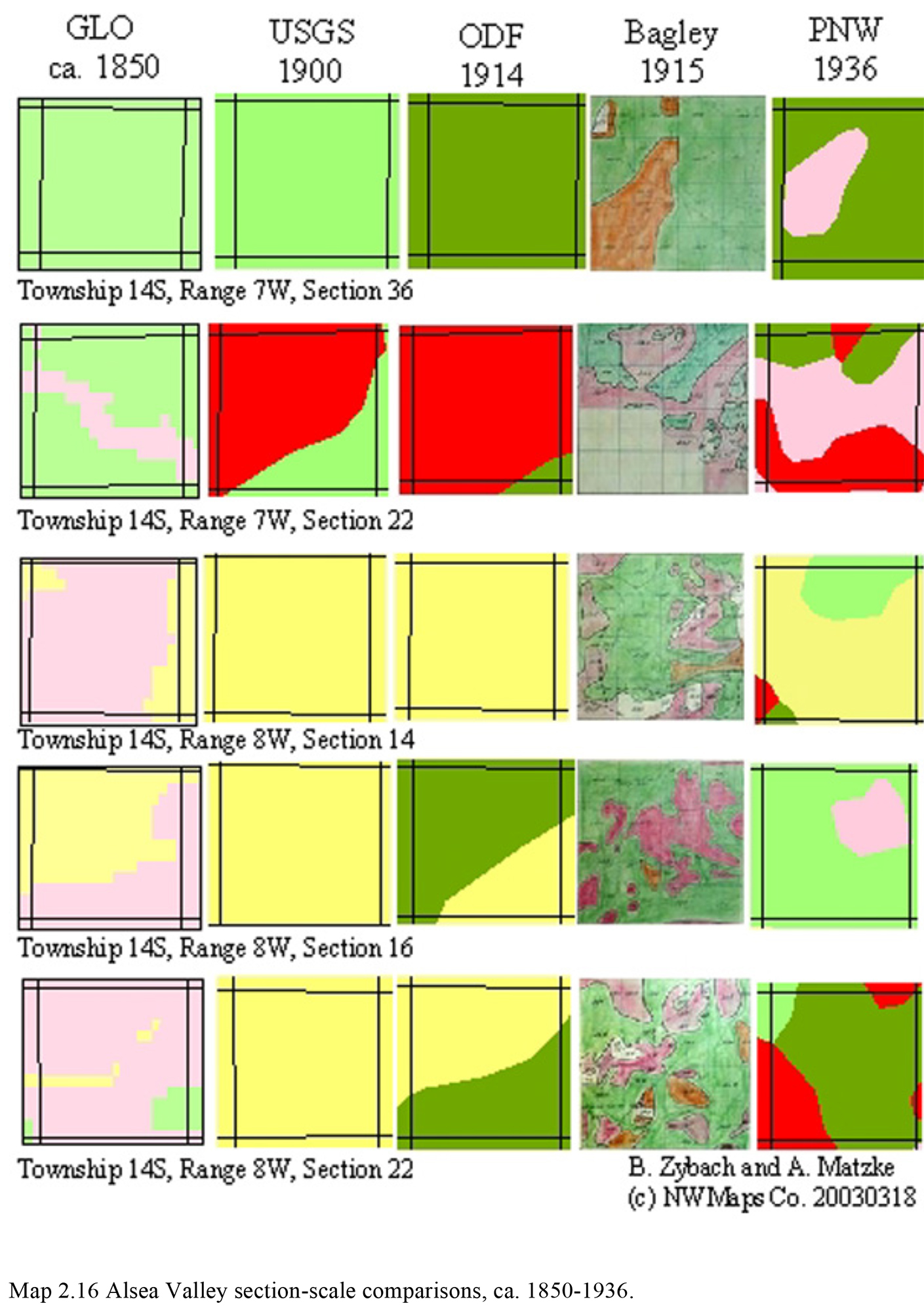
| 2.16 | Alsea Valley section-scale comparisons, ca. 1850-1936. | 95 | JPEG_FREE | |
| 3.01 | Oregon Coast Range tribes and nations, ca. 1770. | 101 | PDF_$5 | |
| 3.02 | Northern Coast Range landscape patterns, ca. 1800. | 126 | PDF_$3 | |
| 3.03 | Soap Creek Valley, ca. 1826 GIS map. | 131 | JPEG_FREE | |
| 3.04 | Soap Creek Valley, ca. 1850 GIS map. | 132 | JPEG_FREE | |
| 3.05 | Eastern Coast Range landscape patterns, ca. 1800. | 134 | PDF_$3 | |
| 3.06 | Western Coast Range landscape patterns, ca. 1800. | 139 | PDF_$3 | |
| 3.07 | Southern Coast Range landscape patterns, ca. 1800. | 142 | PDF_$3 | |
| 3.08 | Oregon Coast Range cultural landscape patterns, ca. 1800. | 144 | PDF_$3 | |
| 4.01 | Historic Oregon Coast Range forest fires, 1750-1933. | 147 | PDF_$5 | |
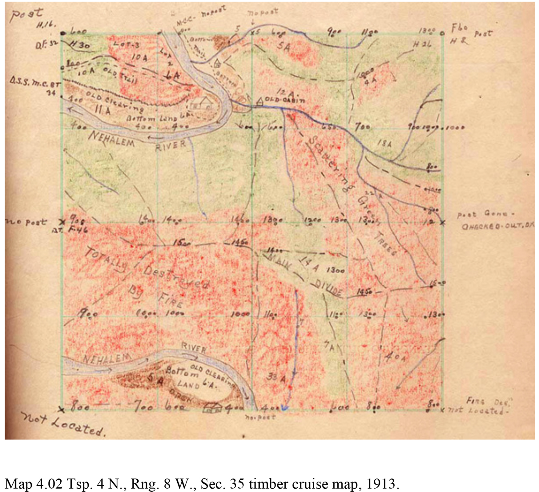
| 4.02 | Tsp. 4 N., Rng. 8 W., Sec. 35 timber cruise map, 1913. | 178 | JPEG_FREE | |
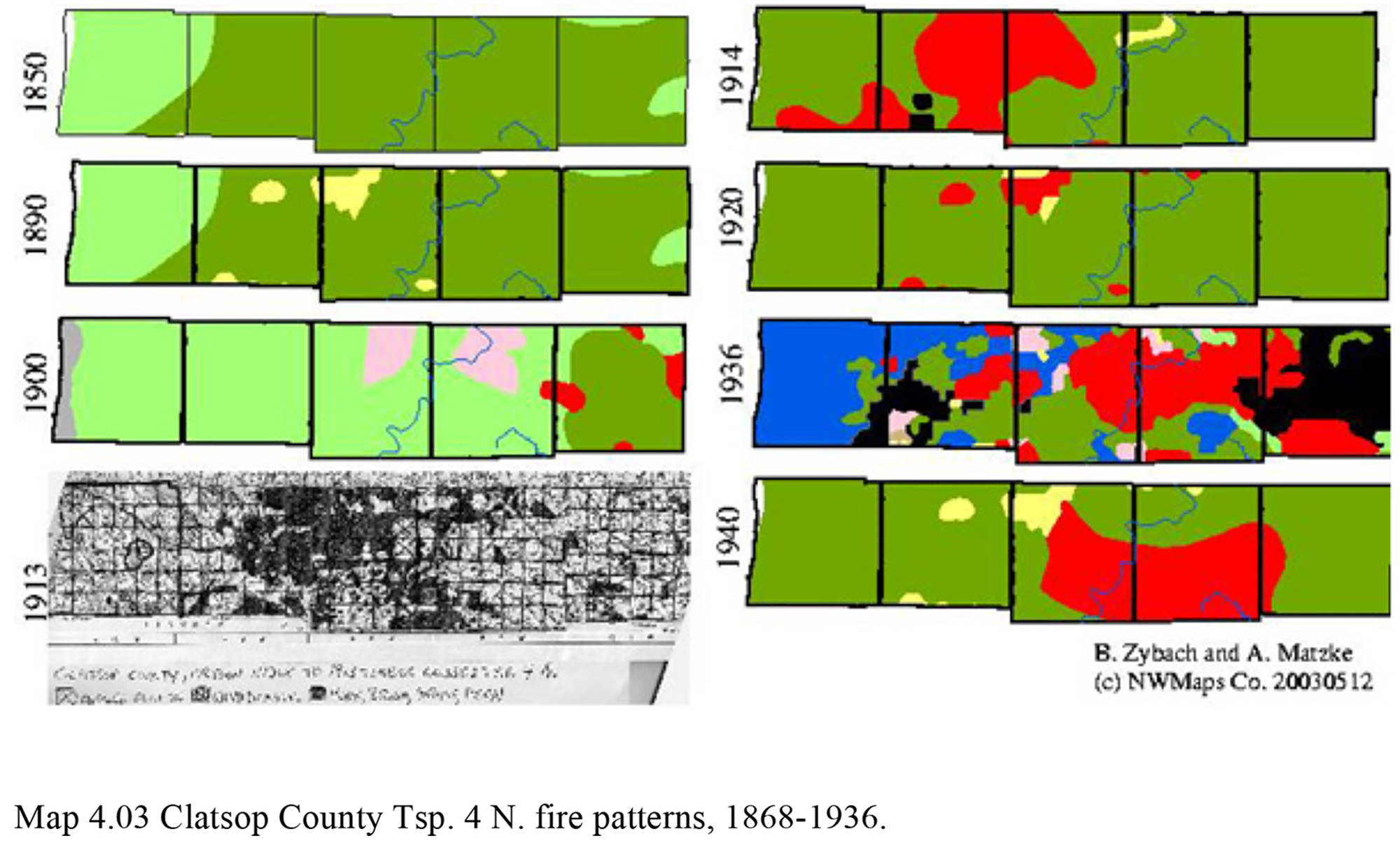
| 4.03 | Clatsop County Tsp. 4 N. fire patterns, 1868-1936. | 180 | JPEG_FREE | |
| 4.04 | Northern Oregon Coast Range forest fire patterns, 1720-1936. | 181 | PDF_$5 | |
| 4.05 | Clatsop County logging patterns, ca. 1900-1935. | 182 | JPEG_FREE | |
| 4.06 | Columbia County logging patterns, ca. 1900-1935. | 183 | JPEG_FREE | |
| 4.07 | Soap Creek Valley cultural forest age classes, 1650-1992. | 186 | JPEG_FREE | |
| 4.08 | Eastern Oregon Coast Range forest fire patterns, 1720-1936. | 187 | PDF_$5 | |
| 4.09 | Western Oregon Coast Range forest fire patterns, 1720-1936. | 189 | PDF_$5 | |
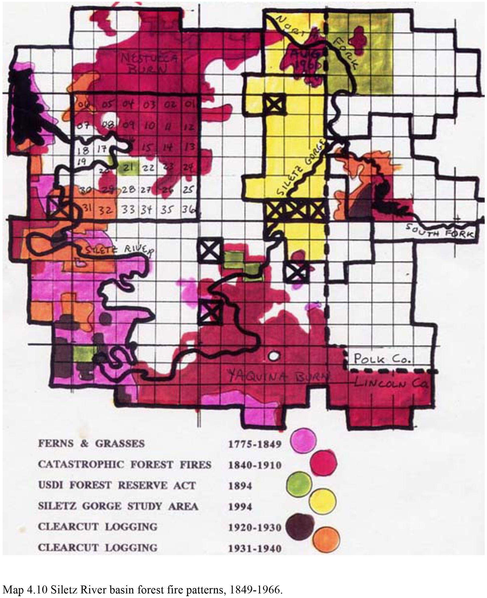
| 4.10 | Siletz River basin forest fire patterns, 1849-1966. | 191 | JPEG_FREE | |
| 4.11 | Alsea Valley forest fire patterns, 1900-1936. | 192 | PDF_$3 | |
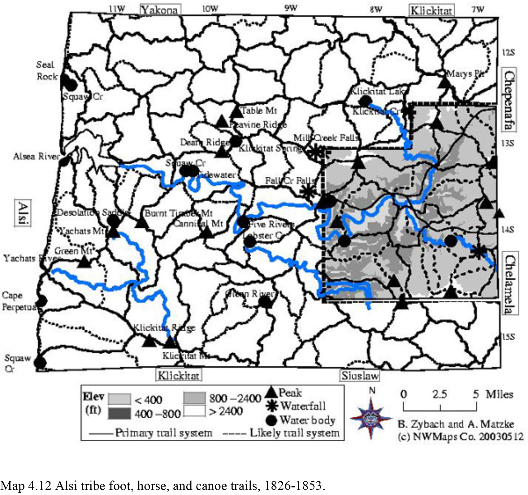
| 4.12 | Alsi tribe foot, horse, and canoe trails, 1826-1853. | 193 | JPEG_FREE | |
| 4.13 | Alsea River basin forest fire patterns, 1849-1936. | 194 | PDF_$3 | |
| 4.14 | Coos Bay forest fire patterns, 1895-1936. | 196 | PDF_$3 | |
| 4.15 | Southern Oregon Coast Range forest fire patterns, 1720-1936. | 197 | PDF_$5 | |
| 6.01 | Land ownership patterns of the Oregon Coast Range, 2003. | 233 | PDF_$3 | |
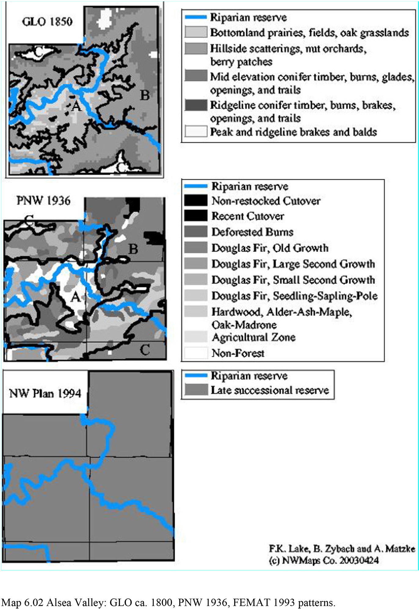
| 6.02 | Alsea Valley: GLO ca. 1800, PNW 1936, FEMAT 1993 patterns. | 236 | JPEG_FREE | |
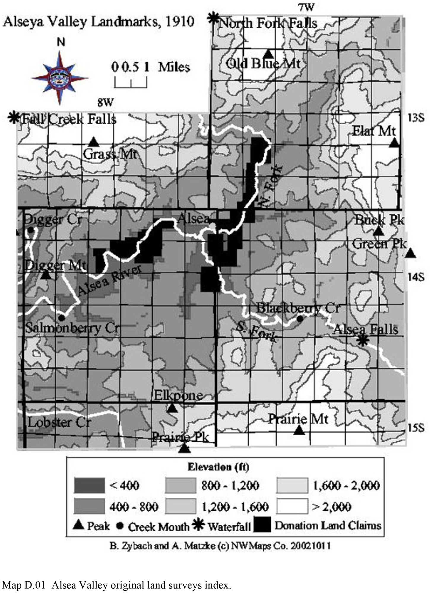
| D.01 | Alsea Valley original land surveys index. | 302 | JPEG_FREE | |
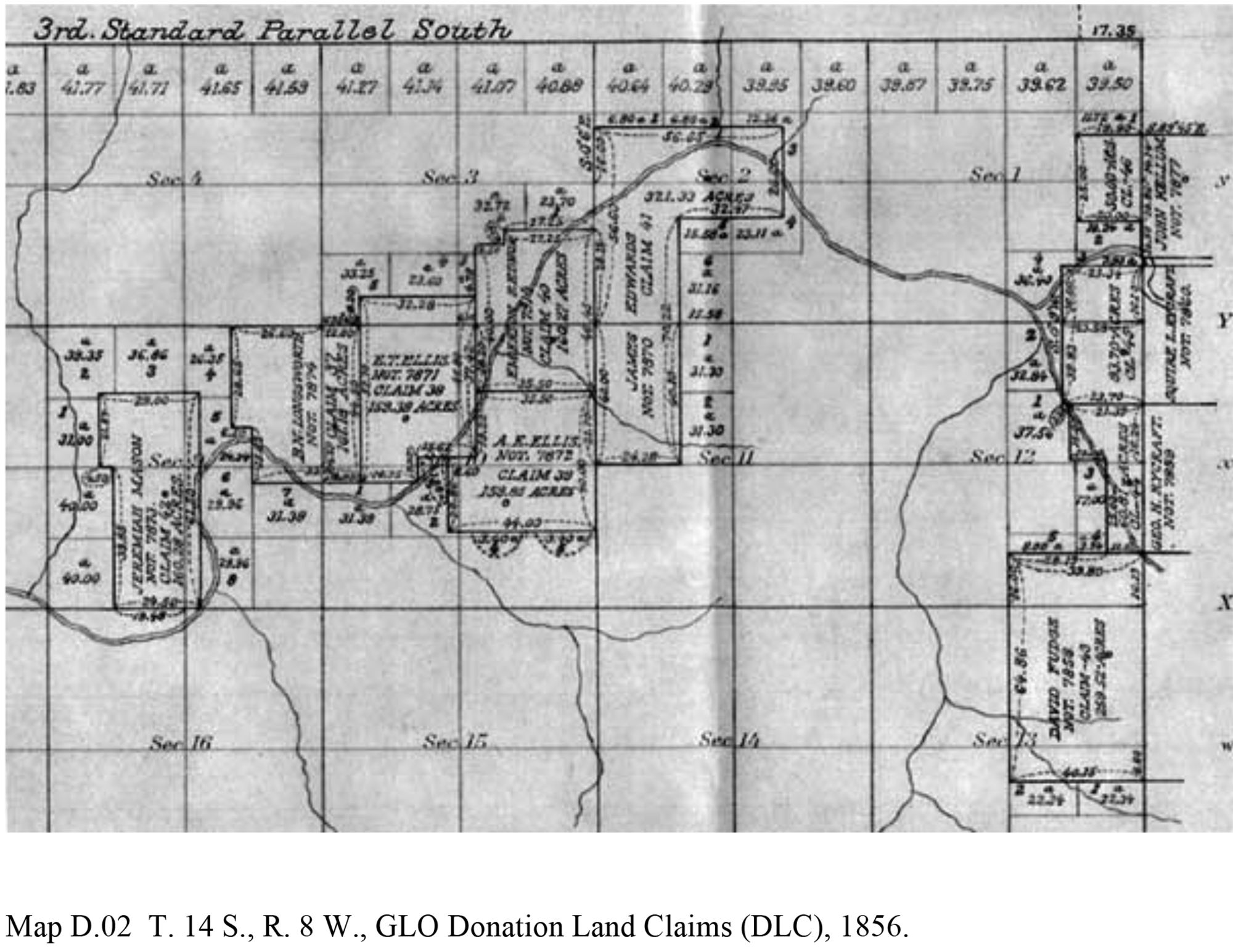
| D.02 | T. 14 S., R. 8 W., GLO Donation Land Claims (DLC), 1856. | 305 | JPEG_FREE | |
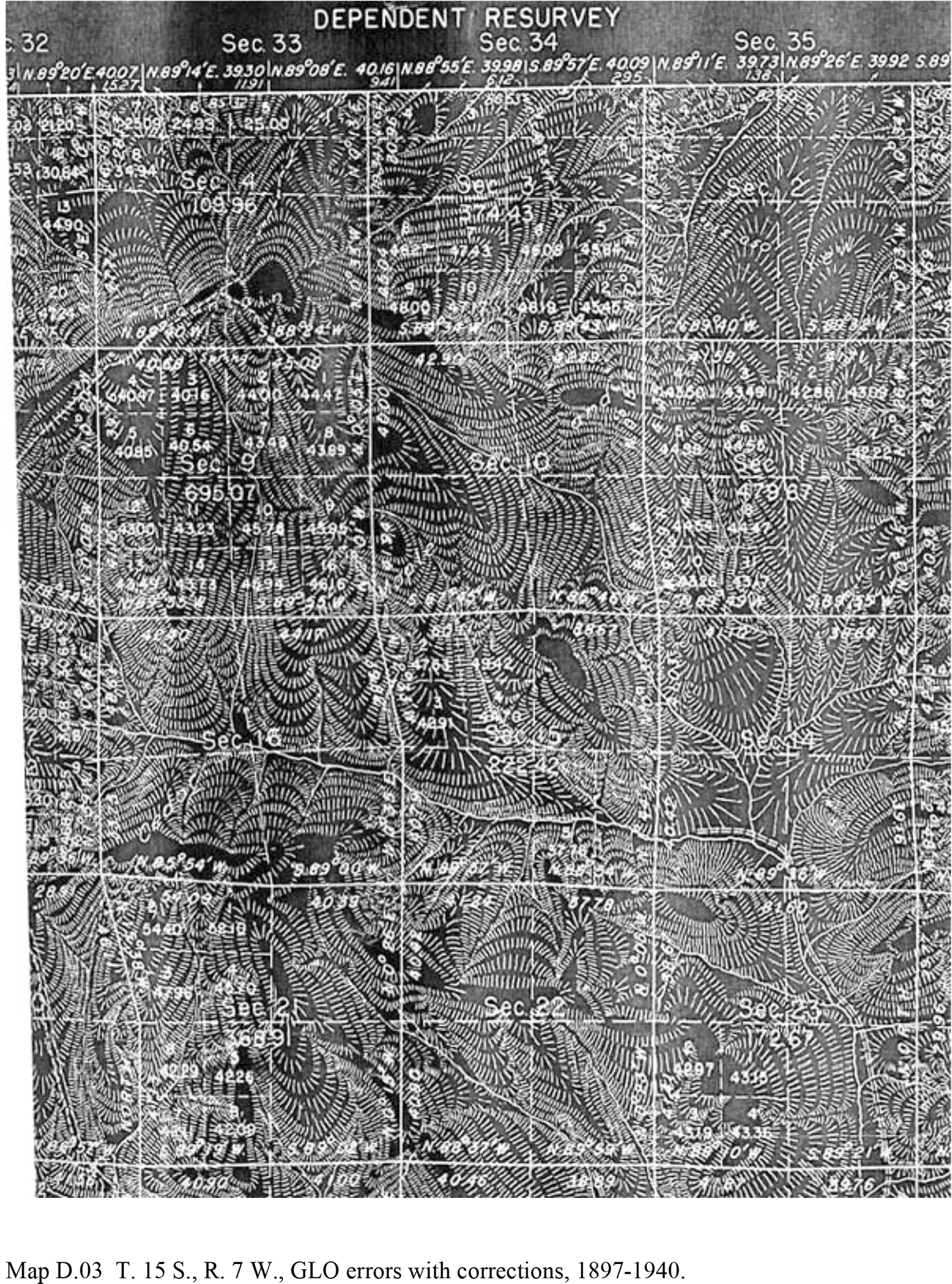
| D.03 | T. 15 S., R. 7 W., GLO errors with corrections, 1897-1940. | 307 | JPEG_FREE | |
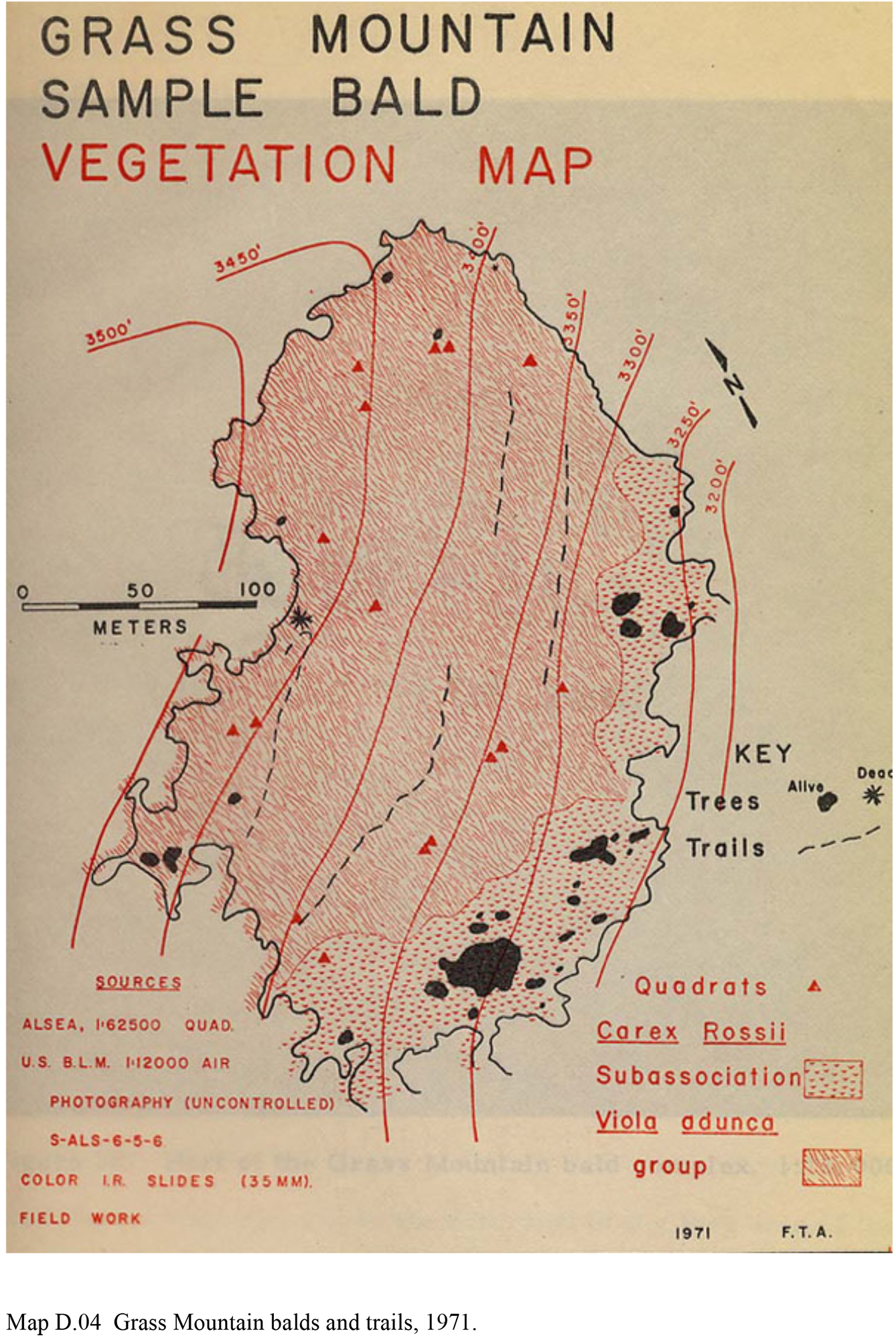
| D.04 | Grass Mountain balds and trails, 1971. | 310 | JPEG_FREE | |
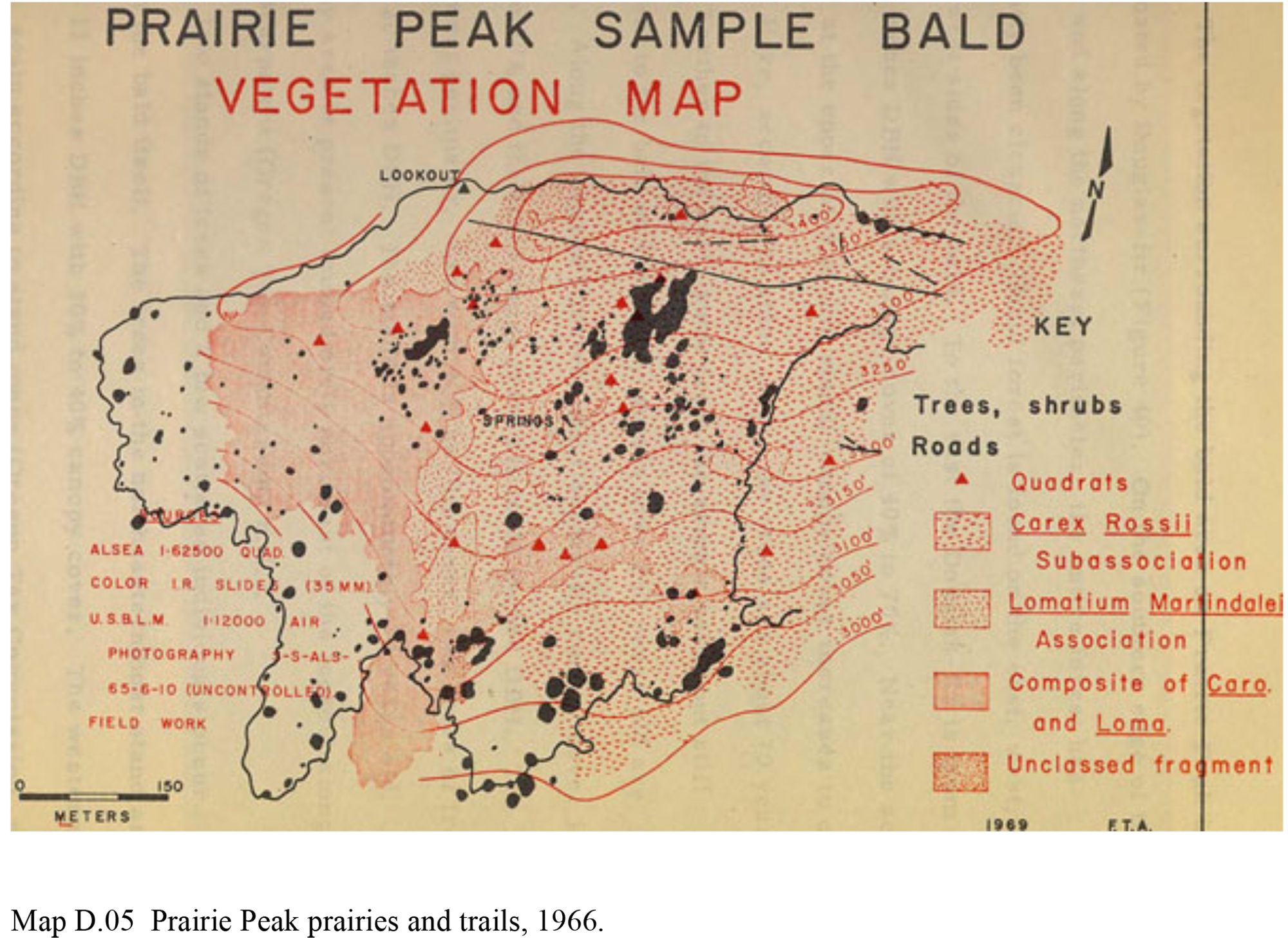
| D.05 | Prairie Peak prairies and trails, 1966. | 320 | JPEG_FREE | |
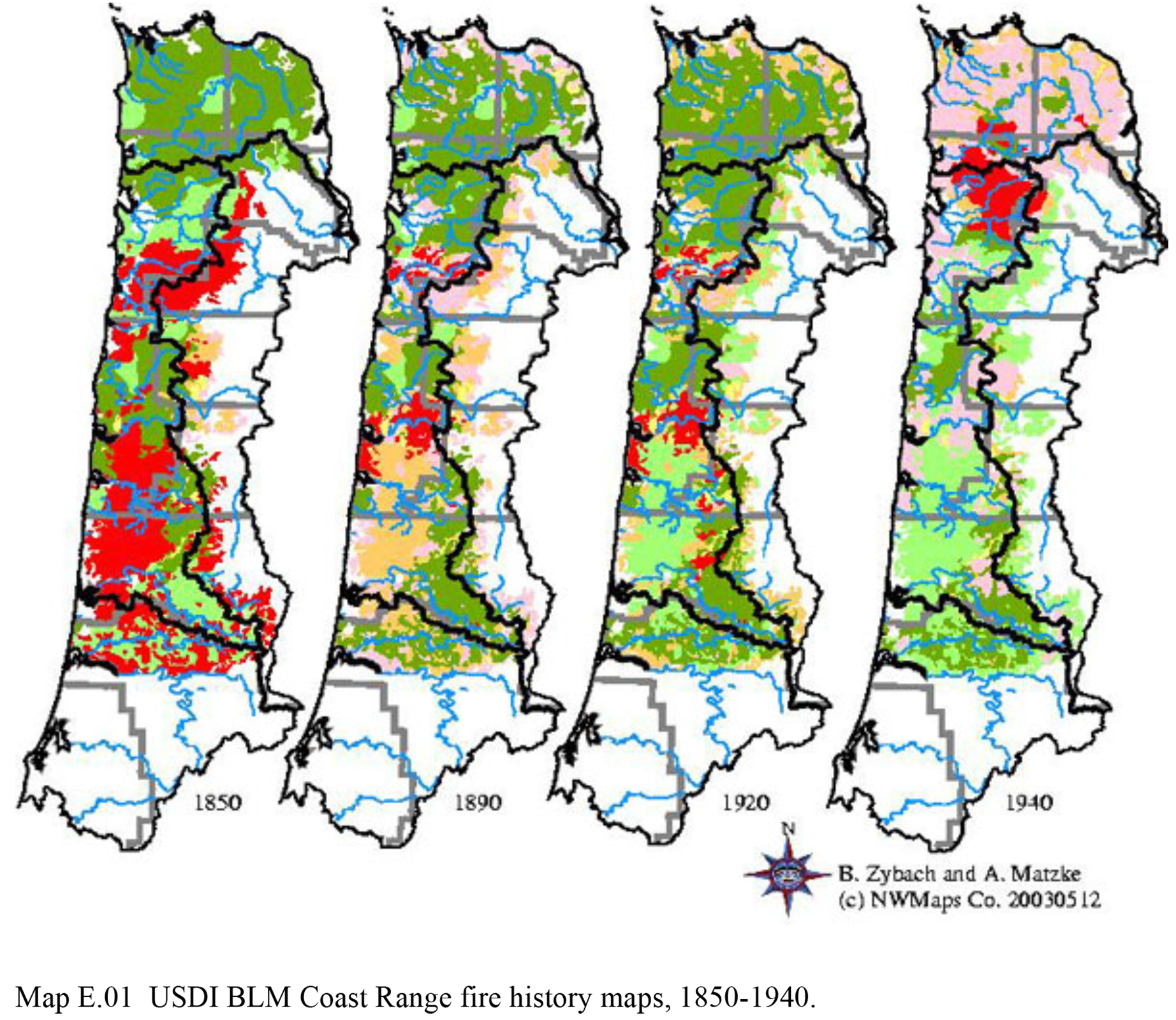
| E.01 | USDI BLM Coast Range fire history maps, 1850-1940. | 326 | PDF_$3 | |
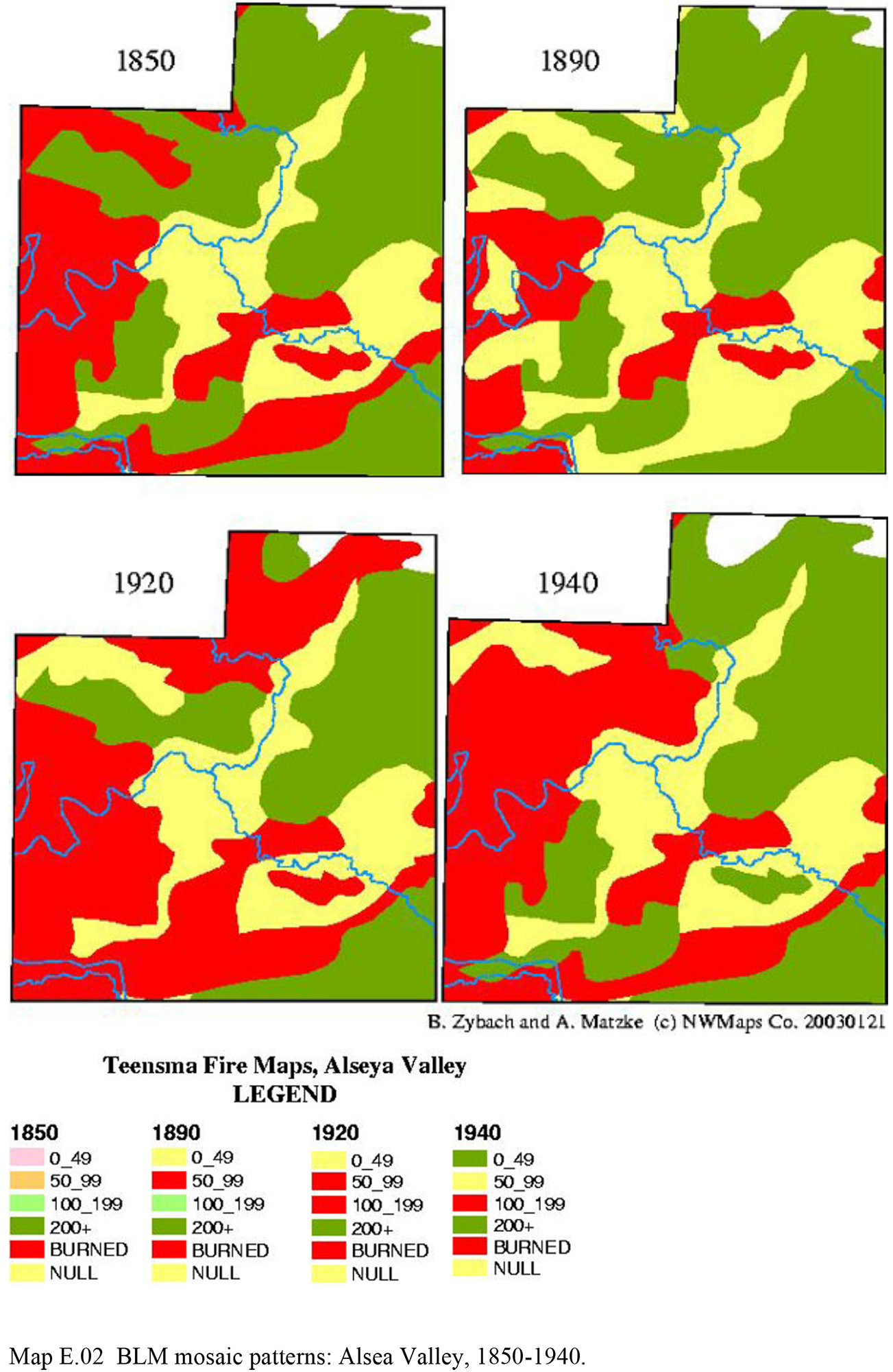
| E.02 | BLM mosaic patterns: Alsea Valley, 1850-1940. | 327 | JPEG_FREE | |
| E.03 | Pacific Ocean coastal strip comparisons, 1850-1940. | 328 | JPEG_FREE | |
| E.04 | Thematic map vs. historical map: 1933 Tillamook Fire. | 329 | JPEG_FREE | |
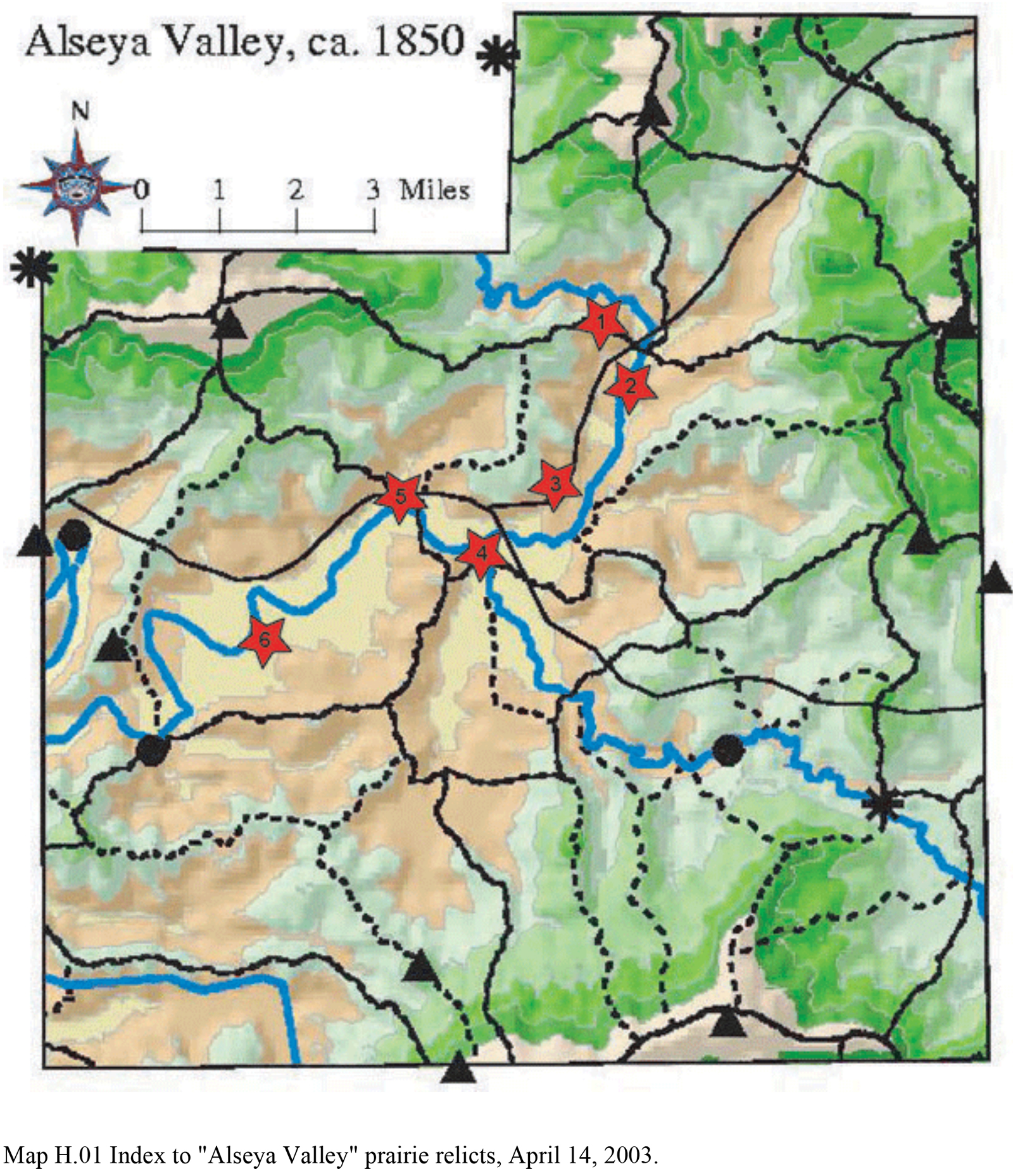
| H.01 | Index to "Alseya Valley" prairie relicts, April 14, 2003. Note: This map locates photo points for Figures in Appendix H. |
337 | JPEG_FREE |
![]()